2016 (old posts, page 1)

Bonjour, Montpellier

I woke up yesterday morning in Montpellier, France, my home for the next 12 months. Here is the view of our neighborhood from the roof.

https://c1.staticflickr.com/9/8664/28212652704_6479847ff1_b.jpg

I'm happy to be here, with the last week of house cleaning and travel preparation far behind me. The trip itself, except for delays, was easy. My kids and I (Ruth and our dog went 4 days earlier to save money) wrangled our bags through many halls, stood in many lines, sat in many seats, and emerged into sunshine just as our patience was about to end.

https://c1.staticflickr.com/9/8678/28227771533_5b2edca713_b.jpg

I haven't left the house except to run with my dog across the river to Castelnau-le-Lez, the village next door, and to walk around the neighborhood with my family after dark to enjoy the silence of vacation season, see the stars, and spot geckos hunting for insects under the street lights. Friends have come by to welcome us back and I've unpacked and stashed our empty luggage. In a few minutes I'm going to log in and begin to catch up on projects and look forward to going out to visit friends this evening. There are a bunch of tasks ahead of us this week: getting new phone service and bank accounts, school registration, meeting with a French tutor, and shopping for home and office supplies, but I'm going to put these off for a few more hours and enjoy a break from lines and service counters.

Crazy Legs 10K 2016

Yesterday morning I got out of bed at 5:00 a.m. to eat a bowl of cereal and a banana, drink a cup of coffee and a quart of water, and drive down Taft Hill Rd to Devil's Backbone Open Space for this year's edition of the Crazy Legs 10K trail run. Like last year, the weather was beautiful, the trail dry, the greenery very green. During the drive, I saw our Moon appear to go down directly behind Longs Peak. It is, of course, the other way around: the Moon, the horizon, and Longs Peak each move eastward relative to the stars, but the mountain's apparent velocity is 27 times faster.

I ran the steep and rocky course in 1:04 (unofficially), one minute faster than last year, and finished in 17th place (up 7 spots). Best of all, I did not fall on the trail's notorious rocks the one time I stumbled.

In my race packet, I found this.

https://c2.staticflickr.com/8/7368/27193799245_58d4575480_b_d.jpg

A handwritten thank you note from the organizer to every entrant. A classy detail of a thoroughly classy event.

Colorado Marathon 2016

Sunday, the 1st of May, I started and finished my first Marathon.

The only thing I don't like about this race is the godawful early start. I know that the first weekend in May can be uncomfortably warm here and understand that an early start makes restricting traffic on CO-14 more feasible, but in order to eat and begin to digest an adequately sized blob of oatmeal before the 6:30am start I had to set my alarm for 3:30. At 4:30 Ruth and I were headed to a parking garage downtown and at 5:00 we were on buses to the starting line.

It was cloudy and dry downtown, but a little more wet in the canyon and about 14 miles up we reached the snow line. At the Stevens Gulch trailhead I saw about 4 inches of wet snow on unpaved surfaces. It was 34° F (1° C).

https://c2.staticflickr.com/8/7188/26357748774_e48c7cb1ab_b_d.jpg

At the last minute before leaving the house, I had switched to a long-sleeved shirt under my ultralight wind/rain jacket and was glad I had when we arrived. I'd already committed to wearing tights, hat, and light gloves and found this to be just about right for the conditions. A more breathable jacket would have been better: I ended up slightly wet from the inside due to condensation and fairly cold between finishing my gel packs at mile 16 and reaching "Bagel Hill" at mile 19.

https://c2.staticflickr.com/8/7261/26929703676_d1f5fea295_b_d.jpg

I had a hard time finishing. My hamstrings threatened to cramp up as I sped up on the last steeper downhill stretch around mile 12, but I survived that and was feeling pretty good until mile 18 when the quadricepds muscles in each of my legs began to cramp. I battled quad cramps of increasing frequency and duration the rest of the way in. The 3:45 flag that I'd been closing in on for an hour got away from me and the 4:00 flag passed me at about 20 miles. The final 6 miles were brutal: miles 20-23 were the worst, but once I crossed Taft Hill onto sections of the Poudre Trail I've run for almost 20 years, I regained enough confidence and energy and a sense of too-close-to-fail to put in a very modest kick at the end. My time was 4:24, which was just in the second half of all finishers.

I don't understand the cause of the cramps, but can think of a few factors which might be implicated. The course, while never steep, descended much more than any of my training runs, about 300 meters. It wouldn't surprise me if I wasn't quite in the stride that I'd been training for. Also, while I'd run farther than 18 miles in training, I hadn't done so at race pace. I was confident that I'd be able to go a bit harder/longer than I had in training without breaking down, but found I could not. I'm going to train a little more for the next one. Lastly, the week before the race was super hectic. I was fighting fires all day long and sleeping poorly at night, and wasn't as rested as I'd hoped to be.

Friends have been reminding me that it's super cool to finish my first marathon and I really appreciate this perspective: it was harder than I can expected and I'm satisfied to have been able to fight through a bit of adversity and finish.

Ruth's race went better. She had just returned from a speaking tour on April 30 and briefly considered bailing on the half-marathon to catch up on sleep and nurse our ailing dog, but ended up running very well with a personal best time of 2:00:12.

Montpellier Sabbatical II

Between July 2009 and July 2010, I and two little kids rode Ruth's sabbatical coattails to Montpellier in the south of France. This was my first blog post on arrival: https://sgillies.net/2009/07/06/nous-sommes-arrivs-montpellier.html. Seven years later, we're headed back to the Hérault (34)! I'm super excited and a bit anxious, the next few months are going to be a bit crazy.

https://c1.staticflickr.com/5/4124/4831955788_39edb3e93d_b_d.jpg

Moving to France for a year involves a lot of smaller tasks. Some of these we have already ticked off:

  • Ruth is going to be hosted by CGBP (Centre de Biologie pour la Gestion des Populations – Population Biology) again. Great people, great facility.
  • I've got the +1 and support from my team at Mapbox.
  • We've found and made a deposit on a house in Montpellier. The proprietaires are university profs and very helpful.
  • We have a date at the French Consulate General in Los Angeles to get long stay visas. This is a new twist, last time we took care of this in France.
  • We've tuned up our French language skills. I expect our kids are going to impress their teachers.

Ruth found a rental house in the country that was just 5 mins from her lab via VTT (mountain bike) singletrack (!!) but we decided to go with a house in a more central Montpellier neighborhood.

There is yet much to do:

  • Find renters for our house in Fort Collins.
  • Pack and ship essentials across the ocean (our 7 and 10 year-olds have much greater requirements than last time), and store other stuff locally.
  • Learn how to transport a dog to France.
  • Find some late summer or fall trail running races in Europe to replace the Black Squirrel race I'd otherwise run here in September.
  • Plan our upcoming vacations. the French do this well in advance and you run the risk of finding everything is booked if you wait till the last minute.

Fort Collins and Montpellier have a lot in common. Both are fast-growing university and government centers with sunny climates and good access to outdoor recreation. But there are things Montpellier has that Fort Collins does not:

  • Year-round farmers markets. Local strawberries in April (now!) with cherries and other fruit not far behind.
  • Excellent local wine regions like La Clape and Pic Saint-Loup.
  • The Lucques variety of olive.
  • Bakeries. The Crêperie here in the Fort is good, but there are many places in Montpellier making baguettes just as well. And the sourdough (levain) baking in Montpellier is much better.
  • Merguez sausage.
  • Fresh fish and oysters.
  • A short drive to the beach.
  • TGV connections to Paris and Barcelona. Just 3 hours to each.
  • Historical public places like Place de la Comédie and the Promenade du Peyrou.

It's not all milk and honey, however. Montpellier also has hellish traffic (I don't expect it's any better seven years later), high unemployment, ghettos of poorly integrated immigrants, and a large homeless population. It's grittier than Fort Collins, more troubled, and in that sense more real.

I'll write more about the move when summer arrives.

Rasterio 0.34

Last fall Even Rouault announced that GDAL 2.1 would have a new Amazon S3 virtual file system. Extending GDAL's capability to make HTTP byte range requests to AWS's HTTPS + XML S3 API, Even has made it possible to efficiently access partial content of S3 objects using certain formats like GeoTIFF. In other words, metadata of a GeoTIFF on S3 or overviews stored as sub-images can be accessed without retrieving the bulk of its image data. Génial!

With help from Even, Rob Emanuele, and Matt Perry, Rasterio 0.34 has a handy abstraction for this feature. Rasterio uses s3:// URIs instead of GDAL's /vsis3/ paths because URIs are how we identify resources on the web and because this is the URI scheme – if unregistered – used by the AWS Command Line Interface. The same URIs you use with the AWS CLI

$ aws s3 ls s3://landsat-pds/L8/139/045/LC81390452014295LGN00/LC81390452014295LGN00_B1.TIF
2015-03-14 17:20:01   51099231 LC81390452014295LGN00_B1.TIF
2015-03-14 17:20:30    6626356 LC81390452014295LGN00_B1.TIF.ovr

can also be used with Rasterio:

$ rio info s3://landsat-pds/L8/139/045/LC81390452014295LGN00/LC81390452014295LGN00_B1.TIF --indent 2
{
  "nodata": null,
  "dtype": "uint16",
  "crs": "EPSG:32645",
  "bounds": [
    381885.0,
    2279085.0,
    610515.0,
    2512815.0
  ],
  "count": 1,
  "blockxsize": 512,
  "driver": "GTiff",
  "transform": [
    30.0,
    0.0,
    381885.0,
    0.0,
    -30.0,
    2512815.0
  ],
  "blockysize": 512,
  "tiled": true,
  "lnglat": [
    86.96327090815723,
    21.666821827007748
  ],
  "shape": [
    7791,
    7621
  ],
  "compress": "deflate",
  "res": [
    30.0,
    30.0
  ],
  "width": 7621,
  "height": 7791,
  "interleave": "band"
}

Rasterio gets its credentials in the same manner as the AWS CLI (see Configuring the AWS Command Line Interface). If you're already using the AWS CLI no extra configuration is needed to start using Rasterio on S3 raster datasets.

A close read of the GDAL debug logs shows that only 16384 bytes of this 50MB TIFF are fetched in order to get the metadata printed above. That's an efficiency of 3000:1.

The S3 virtual filesystem is only available in Rasterio if you have a GDAL library version >= 2.1.0dev. The macosx wheels for Rasterio 0.34 on PyPI contain GDAL version 2.1.0dev and are probably the easiest way to try this new feature.

Share and enjoy!

Moab from Landsat 8

I've still got the Colorado Plateau on my mind and spent some time yesterday dressing up the image below for a Mapbox Instagram post.

https://c2.staticflickr.com/2/1548/25444509183_637f031af3_b_d.jpg

2016-02-28 was a clear day in Southeastern Utah

I used Development Seed's excellent landsat-util utility to find and download the source imagery, rio stack (from Rasterio) to combine individual bands into an RGB TIFF, rio clip to extract a smaller region, rio convert to scale and reformat the 16-bits per band TIFF into a 8-bit per band PNG, and Imagemagick for sigmoidal constrast enhancement and alpha adjustment.

All of the above was done using Python 3.5.1, which is now an option for landsat-util 0.13.0.

Spring Break in Arches and Canyonlands

School was out last week, Poudre Schools and Colorado State, and my family and I took a Spring Break trip to hike in Arches and Canyonlands National Parks. We stayed 4 nights in Moab, Utah, the biggest town in Southeastern Utah and 
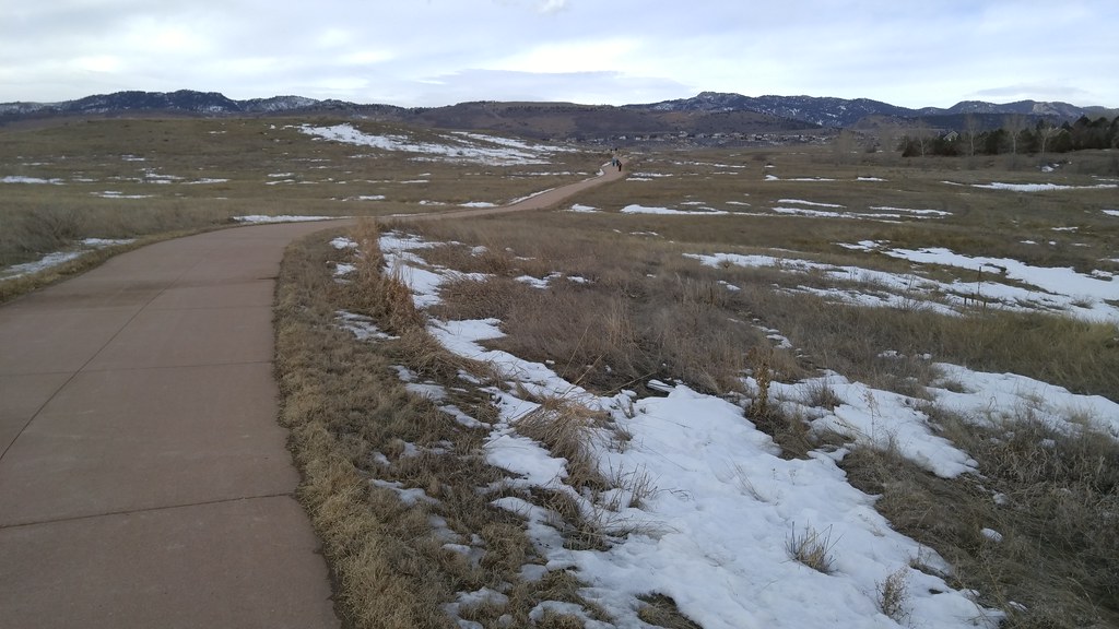
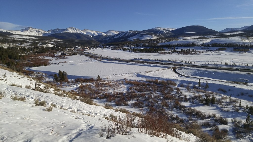
415 miles from Fort Collins. It's a long, but scenic drive, and once we got west of Vail Pass the road was clear of snow and it was all smooth sailing down I-70 to Crescent Junction and then down US-191 to Moab.

I grew up in Utah, have family roots in Southern Utah, visited Arches and/or Canyonlands annually in the 70s and 80s, but haven't been to Moab in a long time. 1992 may have been my last visit. The town has changed a lot on the surface and probably a little bit underneath. Moab's espresso machine population has increased about twentyfold and you can walk out of a craft brewery with a 4-pack of full strength IPA. While grabbing some picnic food in the City Market, I heard Built to Spill's The Plan as shopping music. It's weird. Moab panders shamelessly to the forty-something weekend warrior like me.

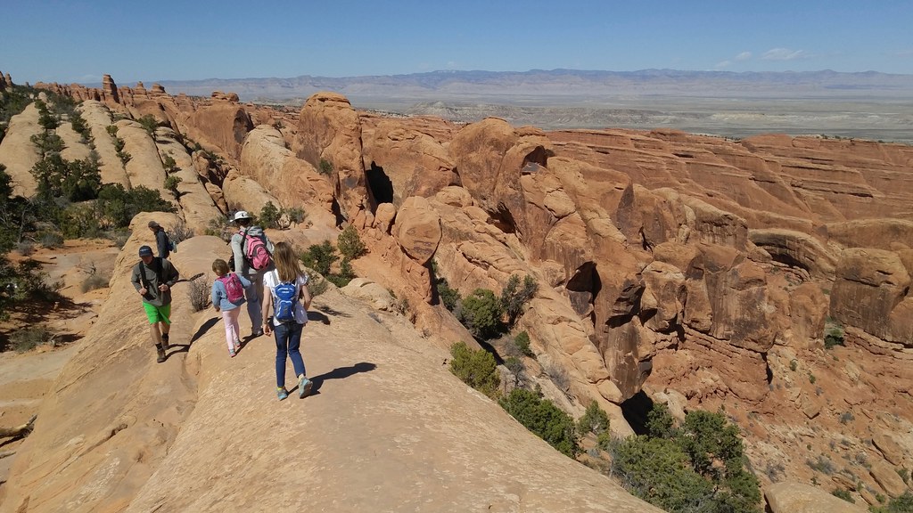
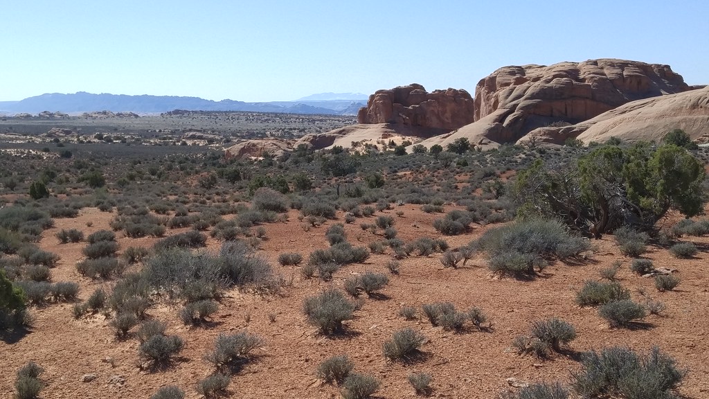
On our first day, we drove into Arches N.P. As you see in the photo below, the dramatic features of Arches are largely found in the brick red Entrada Sandstone that sits atop the buff colored Navajo Sandstone.

https://upload.wikimedia.org/wikipedia/commons/thumb/a/a3/The_Three_Gossips_at_Arches_National_Park.jpg/1200px-The_Three_Gossips_at_Arches_National_Park.jpg

By Sanjay Acharya - Own work, CC BY-SA 3.0, https://commons.wikimedia.org/w/index.php?curid=8101229

There's a particular angle when you're driving back towards the park's visitors center and very close to these titanic figures where one appears to be whispering in the ear of another. Something more serious than mere gossip is going on.

My kids loved scrambling on the park's characteristic joints and fins. These are created by collapse of a deeply buried salt deposit, the sandstone fracturing as its foundation warps.

https://c2.staticflickr.com/2/1540/25332791273_eefb5471a9_b_d.jpg

On the Devil's Garden Trail in Arches N.P.

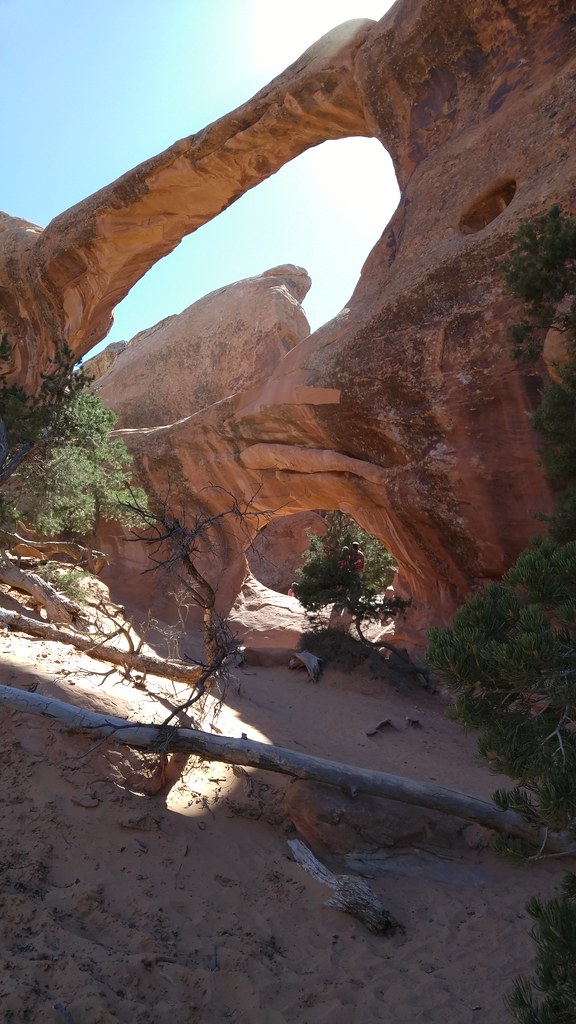
Erosion of the fins can produce free standing rock arches. The park touts over 2000 of them. These arches are ephemeral in geologic time; the iconic Wall Arch (in the same Devil's Garden area) collapsed on August 4, 2008. Landscape Arch, the second longest natural arch in the world, is ever more delicate. According to Wikipedia (no source that I can find) 43 arches are known to have collapsed since 1977.

https://c2.staticflickr.com/2/1639/25660076720_8419dc99c5_b_d.jpg

The Double O Arch

We weren't the only family on the trail that day. We weren't even the only family from Fort Collins, and bumped into people we know from school and soccer. On returning home our oldest learned that her class's student teacher had been to Moab before us, on the earlier end of Spring Break.

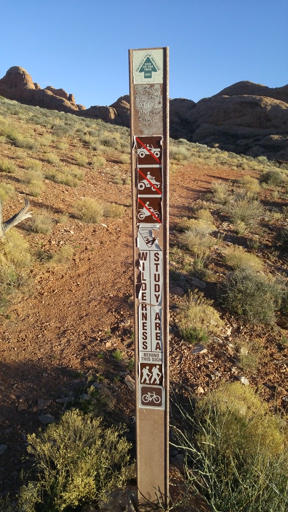
Later that same day I did a 7 mile evening trail run from the BLM's Hidden Valley trailhead up and over the rim southwest of Moab, stopping to check out a few panels of rock art and admire the problems along the Moab Rim jeep trail.

https://c2.staticflickr.com/2/1460/25660096300_d3915c6676_b_d.jpg

Trail sign between Hidden Valley and Moab Rim Trail

There was a point in this run where I realized that I was poorly prepared for any bad turn of events. I'd brought no water, no food, no map, no jacket, no light, and had no internet. I was all alone on the rim, the sun was going down, and the connection between the Hidden Valley and Moab Rim Trails wasn't as obvious as I had expected. Visions of descending from the rim in the dark haunted me as I lost the trail briefly on a slickrock dome, but I managed to find my way through to the jeep trail and its companion hiking trail, named "Stairmaster." Ruth and our kids picked me up at the finish, 30 minutes later than planned, and we went back into town for dinner.

https://c2.staticflickr.com/2/1546/25331941443_4e07a5218e_b_d.jpg

Dome above Hidden Valley

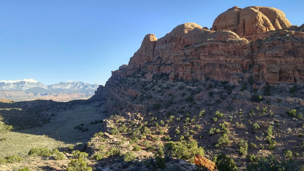
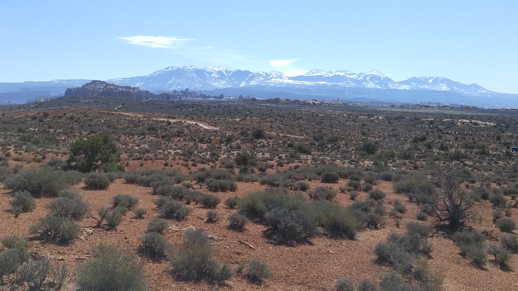
We spent one day hiking in Canyonlands N.P., which was practically empty compared to Arches. The highlights of this day for me were the clear views of the nearby La Sal and more distant Henry Mountain ranges afforded from the Island in the Sky district of the park.

https://c2.staticflickr.com/2/1686/25934818746_dfb76096cd_b_d.jpg

Mesa Arch and La Sal Mountains

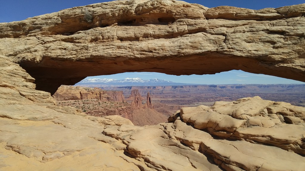
On our last full day in the area we went back to Arches and Ruth and I traded turns at long runs in the backcountry, starting from Balanced Rock.

https://c2.staticflickr.com/2/1644/25960708835_61f538f563_b_d.jpg

Arches backcountry signage

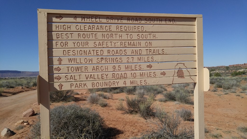
I ran out and back, 14 miles in all, this time with ample water, food, jacket, and map. Just in case.

https://c2.staticflickr.com/2/1479/25960727405_490e772e6a_b_d.jpg

Whale Rock and the Henry Mountains in the distance

I saw only two other people during my run, a couple touring in their Jeep Cherokee. After they confirmed that I wasn't stranded, we headed our separate ways.

https://c2.staticflickr.com/2/1594/25839919082_6da924fdfb_b_d.jpg

La Sal Mountains and the Windows

I've been on a mission to turn my kids into desert rats and I think I've finally succeeded. Every one of us is looking forward to coming back sooner rather than later.

Our admission to the parks was free thanks to Every Kid in a Park, a new White House initiative. Our oldest is in 4th grade and she and her peers can take family and friends to U.S. National Parks through August of 2016.

https://raw.githubusercontent.com/18F/ekip-api/master/ekip/everykid/static/img/nav-logo.png

A cool thing about the initiative's website is that the source is on GitHub: https://github.com/18F/ekip-api. Good job, 18F!

Running in Winter

I'm registered for this year's Colorado Marathon on May 1. It starts about 18 miles up the Poudre Canyon – which will be closed to cars during the event! – and finishes along the Poudre River Trail. This will be my first Marathon.

After taking it easy in October, November, and December. I started an 18 week training program after Christmas. I ran 90 miles in January and 108 in February. I expect to run more miles this March than I've ever run in a single month: over 130.

I'm prone to some wintertime depression and running has been helping me in a bunch of ways. The exercise is good, obviously, and making measurable progress on my accumulated miles and pace is great for my morale. Having a mission has helped me hop out of bed and get outside for daylight and fresh air that I might miss if I went directly to work on my computer (I work remotely, if you remember). I haven't been quantifying my mood this season, but I think it's been relatively good. I've been bringing my dog along on most of my less-than-race-pace runs, as far as 12 miles, and it's been great for her mood, too.

Temperatures have been pretty mild, but we've had plenty of snow. More than ever, I appreciate access to the Parks Department's well-maintained trails. While streets and sidewalks were in a hopeless state, I could always get to the Spring Creek, Mason, Fossil Creek, and Poudre Trails for smooth sailing.

https://c2.staticflickr.com/2/1446/24862154863_2bd365a6a8_b_d.jpg

Poudre River and Trail

https://c2.staticflickr.com/2/1646/25370389592_a851b9f059_b_d.jpg

Fossil Creek Trail

I happened to be in Winter Park on a weekend where I was scheduled to do a long, 14 mile run. I ran from the neighborhood in Fraser uphill from the Safeway, along the Fraser River Trail next to US-40 into the town of Winter Park, then along the wooded and snow-covered stretch of the trail into the Winter Park ski area. I met my family, who were just arriving at the lifts, and then reversed course. I went at a much slower pace than I do at home, so even at 8500-9000 feet, I felt comfortable. The final hill was a killer.

https://c2.staticflickr.com/2/1556/24858266274_383dabb840_b_d.jpg

Fraser River, Winter Park, and Berthoud Pass

https://c2.staticflickr.com/2/1464/25370380092_a3e137f485_b_d.jpg

West end of the Moffat Tunnel

Now Winter seems to be over. Snow is long gone, the foothill trails are drying, and buds are beginning to burst on the trees. I'm looking forward to morning runs with no hat and gloves!

Building I-Ds and RFCs with CircleCI

In the IETF GeoJSON WG we're using the technique described in RFC 7328 -- Writing I-Ds and RFCs Using Pandoc and a Bit of XML to write our drafts and GitHub to collaborate on the Markdown sources. I've configured CircleCI to build HTML, nroff, text, and XML editions of the draft on each push and pull request to catch issues that break the draft building toolchain. I'm not fluent with RFC editor XML and mess up the tagging regularly, so this is helping the WG quite a bit.

Recently I woke up to the possibilities in saving the text and HTML editions as CircleCI build artifacts. Here's the circle.yml file from https://github.com/geojson/draft-geojson:

machine:
  python:
    version: 2.7.10

dependencies:
  pre:
    - sudo apt-get update; sudo apt-get install pandoc
    - pip install -U pip
    - pip install xml2rfc

test:
  override:
    - make
    - head draft.txt

general:
  artifacts:
    - draft.txt
    - draft.html

Under the Artifacts tab on a CircleCI build page, there's a browseable folder hierarchy that exposes links to draft.html and draft.txt.

I should have done this sooner! I may look into including some of the IETF tools like idnits and idspell.