Am I going to do those damn recaps again in 2023? Indeed, I am!
I signed up for my first ever attempt at a 100 miler, the 2023 Bear 100, and this past week was week one of a 36 week plan.
The time on feet and mileage all go up from here. I might do 20 hours and 100
miles or more in a week in July. Week one's numbers are a step up from my
November and December running.
7 hours, 56 minutes
36.8 miles
4,268 ft D+
This weekend I did back-to-back 2 hour runs for the first time since last
August. I did a long slow slog on the bike path yesterday and then a hilly loop
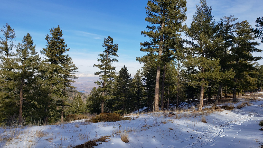
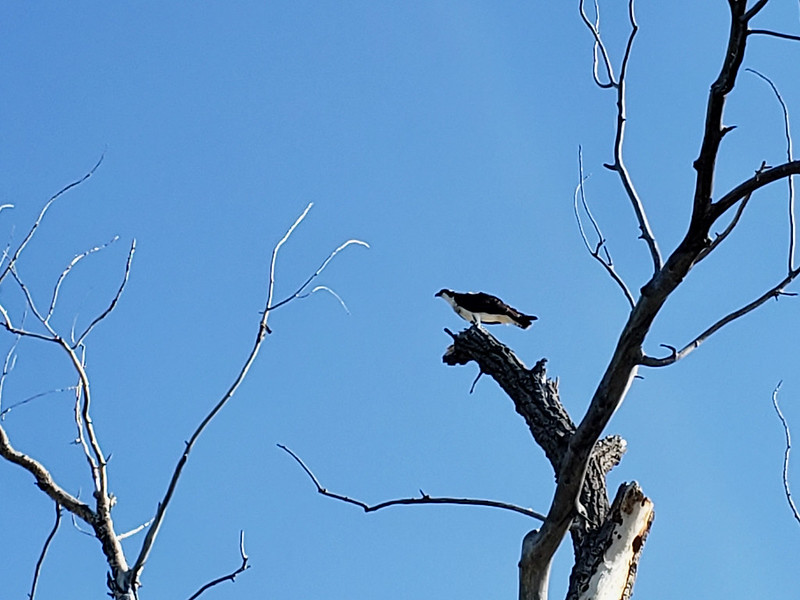
at Horsetooth Open Space today. I saw nobody in the park away from the
trailheads, only birds. On Spring Creek I ran through a large flock of
chickadees and at the Towers crossed paths with a Golden Eagle (Aquila
chrysaetos) which seemed to be doing stooping exercises. From on high it would
tuck its winds and dive headlong toward the ground, pull out of the dive, coast
back up, and then repeat. Larimer County encourages Golden Eagles to nest at
Horsetooth by closing a stretch of the Spring Creek trail each spring. I would
love to hear about some breeding success this year.
View from the Towers-Mill Canyon-Spring Creek junction
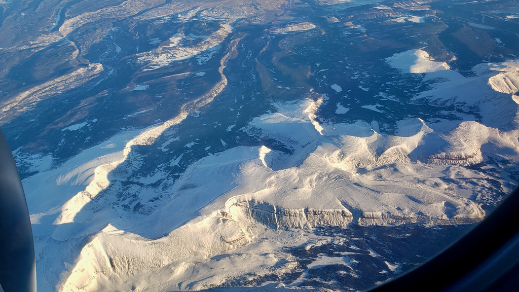
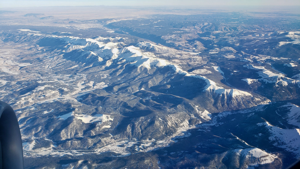
Looking out the window at the landscape below remains the best part of flying.
My family and I went to Boise, Idaho, last week and the views were extra good.
I've driven from Fort Collins to Cody, Wyoming, and Idaho Falls, Idaho, for
Thanksgiving in years past when I had more time than money, but I'm done with
that. BOI-DEN-Fort Collins (last leg by car) takes 5 hours, maximum. Traversing Wyoming on the ground via I-80
(Wyoming alone, not counting the CO, UT, ID legs) in Winter takes 2d6 + 4 hours.
I was on the north side of a 737-900 leaving Boise at 7 a.m. Friday and got
some superb early morning views of the Lost River (ID), Teton (WY), Wasatch
(UT), Uintah (UT), Rawah (CO), and Never Summer (CO) ranges.
Planet Labs, my employer, suggests people take a Friday paid day off every
month. I used mine in October to go on a little adventure that I'd been
thinking about for a couple years: running from my house to the summit of
Horsetooth Mountain and back again. I spent eight and a half hours on the
trail, including many stops for photos, water, and food, covering 33 miles and
4100 feet of elevation gain. Horsetooth Reservoir, 7 miles long and half
a mile wide, was my primary obstacle.
Horsetooth Mountain from Centennial Drive, 5 miles in.
The first four miles were on the Spring Creek bike path and dirt in Pineridge
Open Space. Beyond that was seven miles of road shoulder to go around the south
end of Horsetooth Reservoir and reach the upper
Horsetooth Open Space trailhead. I drive this road once or twice a week, but
had never run it before. It's fairly busy, so I ran strictly on the left and kept
a close eye on oncoming vehicles. Waving and mouthing "thanks" when drivers
give me extra room is my standard practice.
13 miles in, 10 minutes from the summit.
From the Horsetooth parking lot, I had 10 miles of peaceful single track,
mostly all to myself. I took it very easy, only using a little speed to reach
the Lory State Park visitor's center at the north end of Horsetooth Reservoir
before closing time, 4 p.m., to buy a Coke and refill water bottles.
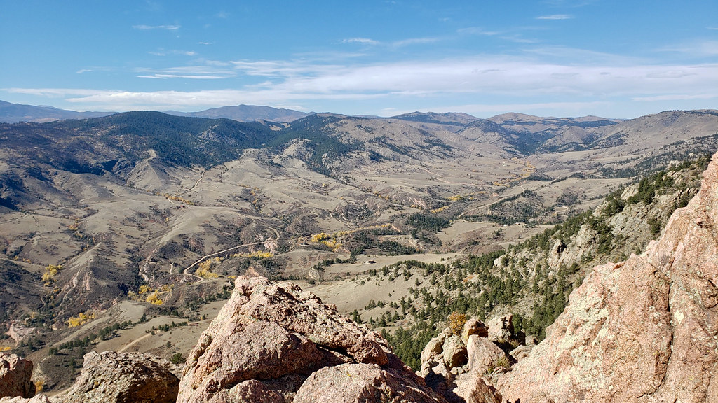
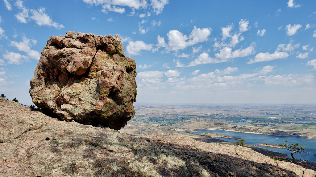
View west from the top.
I found the smuggler's route from the vistor center through to the north
Horsetooth boat ramp, saving me from three additional miles of road shoulder,
ran the road back along the reservoir's east shore to Maxwell Open Space, and
then through Maxwell to Pineridge and back down the bike trail. Overall it was
half road, half dirt.
To cap things off, I ordered Sichuan and Wuhan style noodles from Beijing
Noodle (awesome place, closest restaurant to my house) using my phone's browser
on the trail, and then carried the takeout boxes home on foot while drinking
a beer from the store next to the noodle shop. It was such a satisfying day.
I'll be thinking fondly about this adventure for a while.
We’re hardly four weeks into the Elon era on Twitter and he’s already
cueing up a storyline in which he tried to placate the Blacks and the Jews
and the gays but they betrayed him and set out to “kill Twitter.”
Musk isn't Tony Stark, he's the Donald Trump of batteries and rockets.
During a moment of sun on an otherwise gloomy Sunday, I ran into a flock of
turkeys on Towers Trail.
Post-Superior running is going well. I'm getting some consistent easy miles,
some long runs on the weekends, and am spending quality time with my yoga mat
and foam roller. My plans for next year are still coming together. I'll write
about that more after Thanksgiving.
One of the cool things about blogging is that there aren't a lot of rules.
I had some thoughts about racing at Superior that I wasn't able to weave into
my previous post, so I'm just making a new post about technical aspects of the
race. What I wore, what I carried, and what I ate.
I brought rain gear and extra clothing to Minnesota, and used it on Friday. But
when the forecasts converged on dry and mild for Saturday, I left that gear out
of my pack and drop bags. I sent a pair of shoes (Evo Speedgoats) and socks to
the Cramer Road aid station at 27 miles and a spare headlamp to the Sawbill aid
station at 40 miles. No other non-consumable items. I didn't use the spare
Speedgoats. My feet were still feeling okay at 27 miles. In hindsight, it would
have been better to have sent completely different shoes to Sawbill. A pair with
a different fit, like my Nikes, would have been lovely to change into at 40
miles.
I wore the same clothing all day. Smartwool socks. A very light tech top from
Patagonia. Venerable capilene boxer briefs from REI and slightly ratty, but
lucky, Vuori Banks shorts. I trust these to be non-chaffing at home and they
came through for me again. My Gnar Runners Boco tech trucker was on my head
until sundown, after which I intermittently wore a capilene beanie. I wore my
nylon windbreaker (Patagonia Houdini) for the last seven miles. With clear
skies, the air cooled quickly, but never got very cold. I left my wool gloves
in my pack. I wore almost everything I packed and didn't need anything more.
I'm going to have to retire some of these items soon. Plastic clothing lasts
a long time, but not forever.
I carried everything in my trusty Ultimate Directions Mountain Vest (4.0). It
weighs almost nothing, is breathable, and fits well whether lightly or heavily
loaded. I brought a small first aid kit, but didn't use it. Nor did I use my
sunglasses or small stick of sunscreen. For hydration, I carried three 16-ounce
soft bottles. One was mostly a spare. It was never very warm, and I never
carried more than two full bottles at a time between aid stations.
I brought light hiking poles to Minnesota, the ones I used at the Never Summer
100k last year. They're very helpful on muddy trails and on technical descents
in the dark. I left them in my room at the lodge on race day and didn't regret
it. I would have used them in the last hour of the race if I'd been carrying
them, but they wouldn't have improved my time or saved my feet.
Shoes... I do think that my Speedgoats weren't adequately broken in. The heel
and toe areas were a bit stiff. I did appreciate the famous cushion and traction.
They're a good choice for the Superior Hiking Trail. It's a super rugged trail,
so you need some combination of cushion, armor, or dancer's feet. I ran for
miles with a guy who was wearing the Speedgoat 5, which I have worn for up to
20 miles, but no further, and he loved them. I might see about switching over.
Fuel is the last technical detail to cover. I drank a lot of Tailwind solution.
400 calories worth at six of the 7 aid stations. I stashed pre-measured amounts
in my drop bags to pick up along the way. I sucked down 4 packets of GU and ate
three Stinger waffles and one bag of Stinger chews. I drank 8-10 ounces of
Coke, one of my go-to calorie sources,
at every aid station. I was able to eat plenty of solid food all day long. From
pancakes and sausage in the morning, to mashed potatoes and chicken noodle soup
in the evening. Mid-day I got tired of aid station food and that's when I went
for the chews and gels. I did a much better job fueling than I did at last
year's Never Summer, where I bonked badly in the last 10 miles.
What about crewing? I didn't have a planned crew. My friend David Bitner, a devoted Superior runner and pacer, met me at mile 27 to pump me up and
help me get set for the second half. Outside of that, I found my own groups as
I went. 50 miles, in my experience, is not so long that I need help. I would
love to have some crew help on a 100 mile race and a pacer to help me flow
quickly through aid stations.
That's all the technical notes for the race. I went into it with a B fitness
level, extra pounds, a little uncertainty about my heart, but with experience at this race distance to lean on. I flunked my
shoe choice, but did everything else right, enjoyed tons of support, and had a great time.
Last weekend I traveled to Minnesota's North Shore to run the Superior 50: 52 miles through the North Shore
Highlands and Sawtooth Mountains on the
Superior Hiking Trail. On the Thursday
before the race I flew into Duluth and drove a rental car 90 miles up Highway
61 to a lodge at
the Lutsen Mountains Resort, the finish line for the event. Friday I met David
Bitner and his partner Marin at Tettegouche State Park for lunch and some easy
hiking on the cliffs next to Lake Superior. Marin would be running the Moose
Marathon (the last 26.2 miles of the 50 and 100 mile course) on Saturday and
Bitner, a 100 mile finisher in 2019, would be pacing a 100 mile runner
overnight. After a few hours with them, I drove north again to Grand Marais to
wander around and find a pre-race dinner, and then back to the lodge to sleep
before Saturday's early start.
Finland, MN, 5:00 a.m.
The 50 mile race began at 5:15 a.m. in Finland, Minnesota. A school bus took me
from the finish to the start, leaving the resort at 4:15. Friday's clouds and
rain were gone and the 50 mile race kicked off in calm and cool conditions
under a full moon.
Somewhere on the Superior Hiking Trail.
The Superior Hiking Trail, or SHT, is wild, rugged, and challenging. I estimate
that a quarter of the 50 mile course was fairly runnable. The rest was steep,
or overgrown, or root-bound, or all of the above. You have to watch your feet,
closely. On the other hand, I didn't need sunscreen, because we were traveling
under the canopy of the boreal forest, with only small breaks at river and road
crossings and rocky summits.
My plan was to take it easy in the first third of the course and, if I felt
good, pick up the pace in the second third and try to sustain it through the
final 17 miles. I settled into the tail end of the pack and stayed there until
just before the Crosby-Manitou aid station (mile 12). During this part of the
race I was briefly in a small train with Courtney Dauwalter (two time UTMB
winner and winner of this year's Hardrock 100) and her mom, which was fun. They
say never meet your heroes, but the Dauwalters were friendly and gracious. At
the aid station I got a small cup of coffee, a big pancake and a sausage patty,
and really began to enjoy the race.
Feeling good at the Cramer Road aid station, 27 miles in. Photo by David
Bitner.
I felt great at 17 miles. My heart was behaving properly. My legs felt good.
The trail conditions, considering Friday's rain, and weather were much better
than I'd expected. I found some good company and longer stretches of runnable
trail at this point did my fastest running of the day all the way into the
Sugarloaf aid station at mile 21. I kept going steadily, passing two packs of
runners on the way to the Cramer Road aid station.
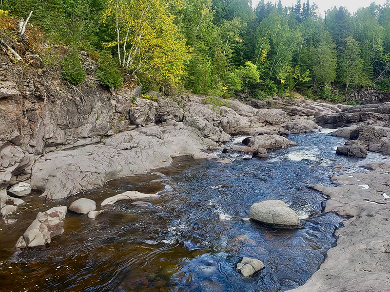
My favorite place on the trail was the Temperance River Gorge. The river's name
is, according to Bitner, a pun: there is no sand bar where it
reaches Lake Superior. I took a bunch of photos of swimming holes just past the
race's Temperance aid station. Not much further downstream the gorge narrows
and deepens dramatically. I didn't take any photos there, but you can easily
find them online. It's a real wonder of nature.
Temperance River Gorge, looking downstream. 34 miles.
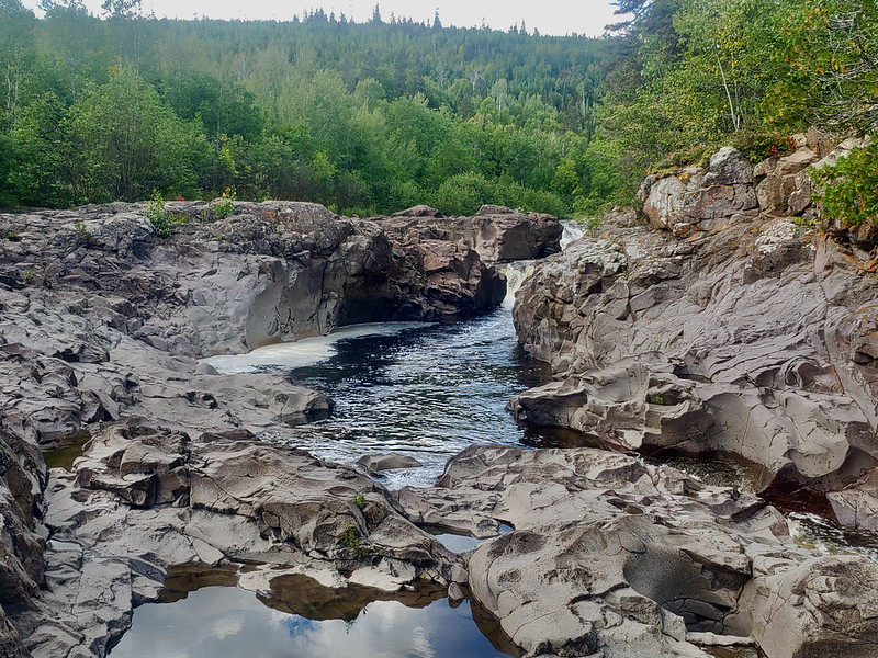
Temperance River Gorge, looking upstream.
In hindsight, I might have neglected to eat enough after Cramer Road. I was
feeling sluggish on the 1,200 foot climb up from the Temperance River
to Carlton Peak. My ambitions of finishing before the sun went down were
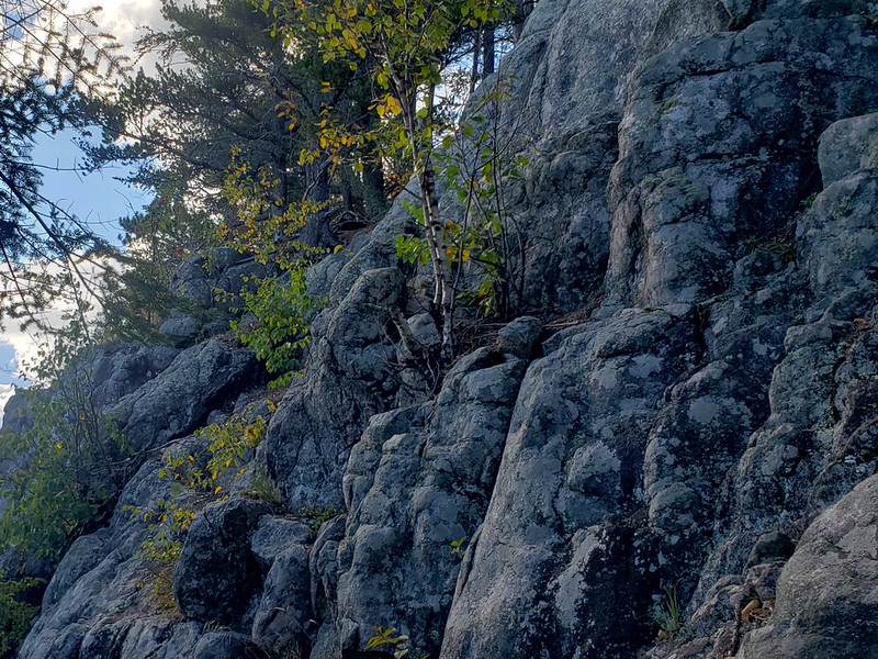
starting to look unrealistic. The trail near the summit was steep and rocky,
not unlike the approaches to Arthur's Rock or Horsetooth. I saw Columbines and
raspberries (flowers and fruit long gone), which also reminded me of home.
Carlton Peak, 38 miles.
Near the Sawbill-Britton aid station I began to catch up to slower 100 mile
runners. Some of them were suffering. Some were perfectly executing their plans
to beat all the aid station cut-off times and finish in just under 38 hours.
Around mile 40, my feet began to literally fall apart. I'm not sure whether my
shoes (Speedgoat 4s with ~25 miles of wear) were inadequately broken in or
I hadn't toughened up my feet enough in training. I only ran 20 miles once this
year before Superior, whereas I ran 20, 25, and 30 miles before Quad Rock last
year. My heels and toes blistered, and in trying to spare them on downhills,
I absorbed more force in my quads than I otherwise would. The last 7 miles were
a slow, painful slog, much of it well after dark. All the people I passed
between miles 21 and 40 caught up to me and left me behind. Going uphill felt
better than going downhill. But I finished! Good company helped. I ran the
last 3 miles with a woman from Littleton, Colorado. We'd run some of the first
few pre-dawn miles together and had some laughs about the rest of the day.
My official time: 15:36:21. This was an extremely well-run event and I can see
why people keep coming back for more. Thank you, Superior volunteers and
friendly runners. Thank you, Bitner and Marin, for lunch and crewing at the 27
mile mark. My biggest thanks are to my family, for putting up with my obsession
and letting me off the hook for chores so I can sleep in during blocks of high
training volume. I couldn't have finished without your support.
I just now found a link to the race director's recap in my inbox. It is here.
I did less running last week, but it was high quality running. Plenty of
technical, hilly single track and strides. Sunday I went for an hour long bike
ride with Ruth instead of running.
4 hours, 9 minutes (running)
19.0 miles
3,097 ft D+
Friday I stopped by the top of Arthur's Rock for a view over Horsetooth
Reservoir and the plains. This Saturday I'll be getting views of Lake Superior.
I want to get ~110 miles and 15,000 ft of climbing in over the next two
weeks.
I pretty much did it. 103 miles and almost 18,000 ft of climbing. My training
is finally coming together and none too soon, with my one race of the year less
than two weeks away.
Today I went back to RMNP to beat the heat and had a great long run on the loop
I did in June, but in the other direction and without snow. I weathered some
afternoon rain and hail, for the first time on a long run, and at the end of
the day dealt with a herd of elk at the trailhead where I had parked. I'm
comfortable being close to mule deer, but adult elk are big and can mess you
up! The smart thing to do is wait for them to move along, or go around, giving
them a wide berth. In about two weeks, male elk will begin competing for mates
and it will become more dangerous to be out in the meadows with them.