Connecting many places
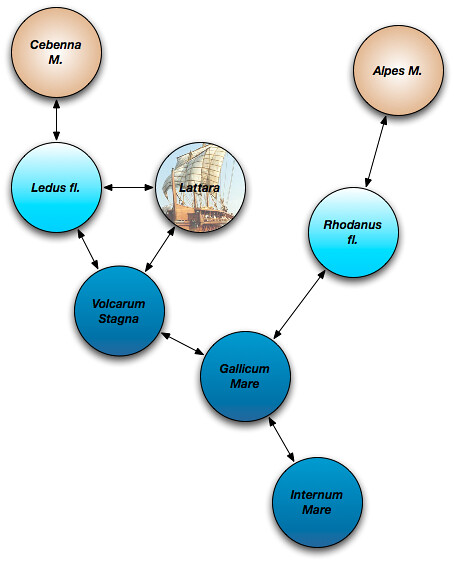
Things you find in Pleiades that you don't find in a typical geographic information system include relationships between places that are expressed in the data itself. I blogged about this last summer (accompanying figure reprised below) and talked about it at the 2011 Digital Humanities conference (our poster here).
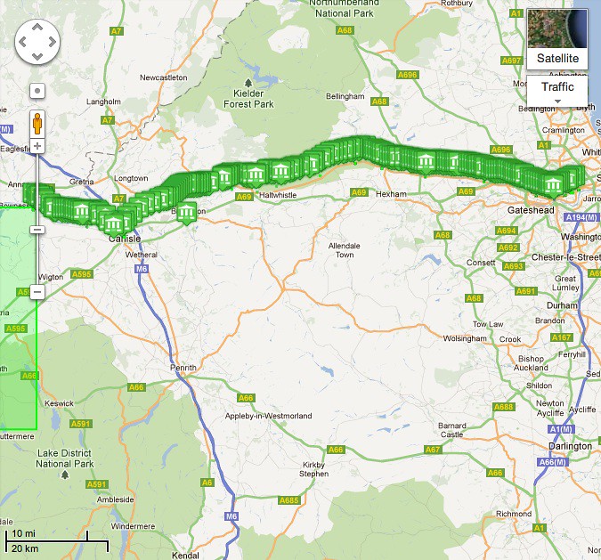
Until today, connections between places have been a little sparse. Loading 200+ milecastles and turrets with connection to Hadrian's Wall changes the situation at least in Britannia. The representation of Hadrian's Wall in Pleiades doesn't have a published spatial extent of its own, but gets one by virtue of its connections to these other small places. Here is a screenshot from Google Maps.
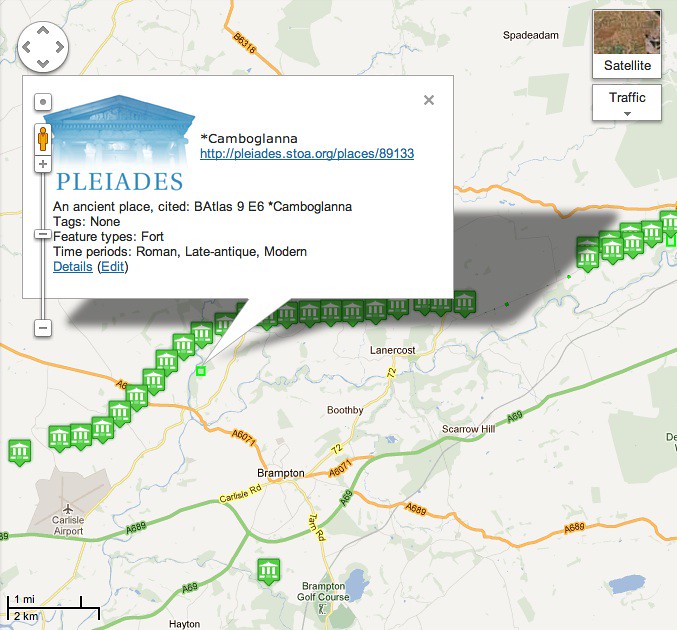
Here's a closeup near Brampton. The lone placemark at the bottom represents an old quarry that supplied nearby milecastles with rock. For the moment at least, we're asserting that the quarry was connected to the fortifications.
The remains of Hadrian's Wall are a popular hiking itinerary today. The connected places in the maps above don't quite describe the itinerary because they aren't chained to each other, but I can't stop thinking that we should be making it possible to represent ancient itineraries like the Antonine using places from Pleiades.